
Professional Services of
SEMATA INDONESIA
Professional Solutions for a Sustainable Future
Managed by
PT REKA GUNA SELARAS,
Driven by Mission of SEMATA INDONESIA
All of SEMATA INDONESIA's professional services — from mapping to project documentation — are operationally managed by our business partners:
PT REKA GUNA SELARAS, an official business entity that acts as a provider of technical services and professional program implementer under the auspices and values of SEMATA INDONESIA.
This collaboration allows SEMATA INDONESIA to remain focused on advocacy, conservation, and community empowerment, while ensuring that the quality of services is carried out professionally, legally, and according to industry standards.
Every project with us is a collaboration between NGO integrity and business unit efficiency.
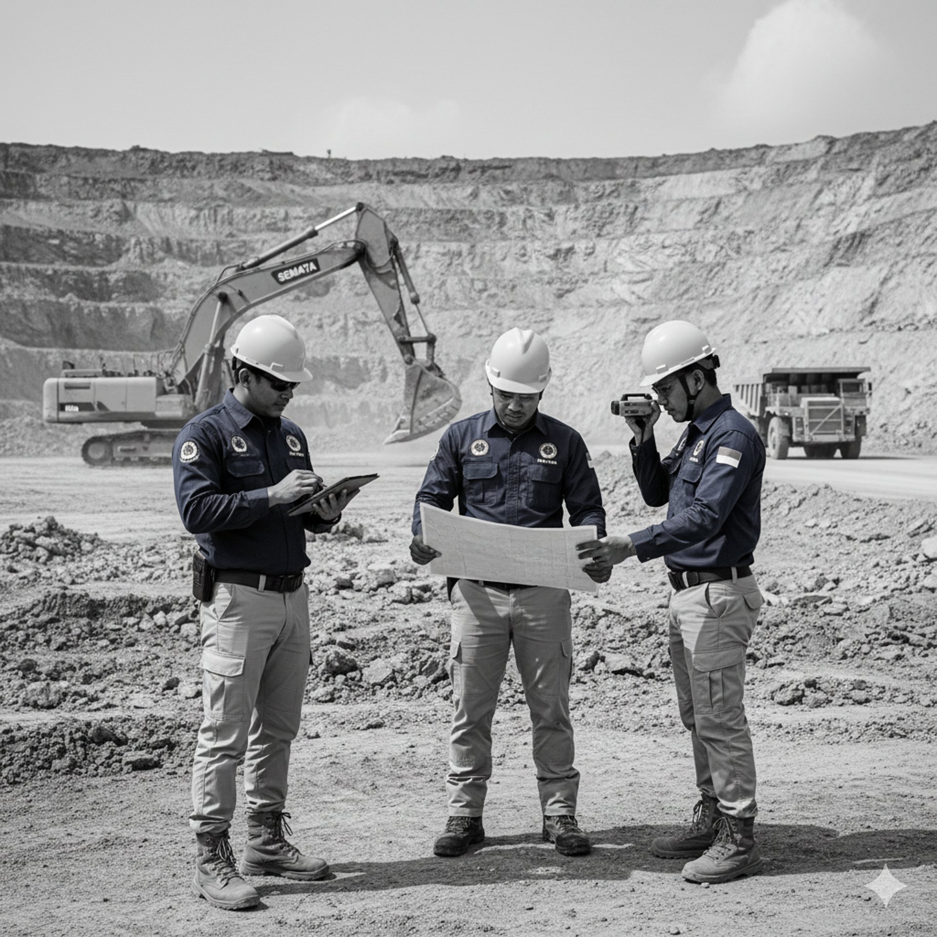
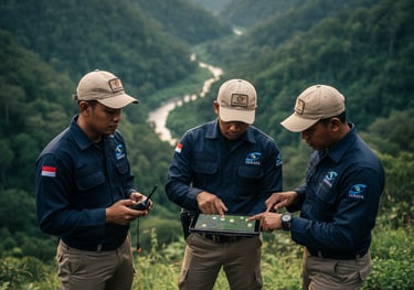
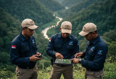
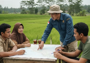
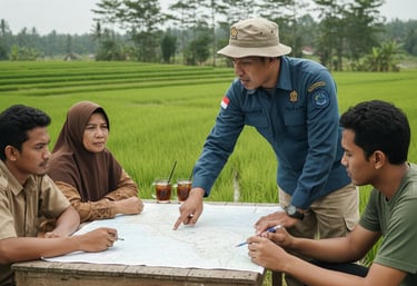
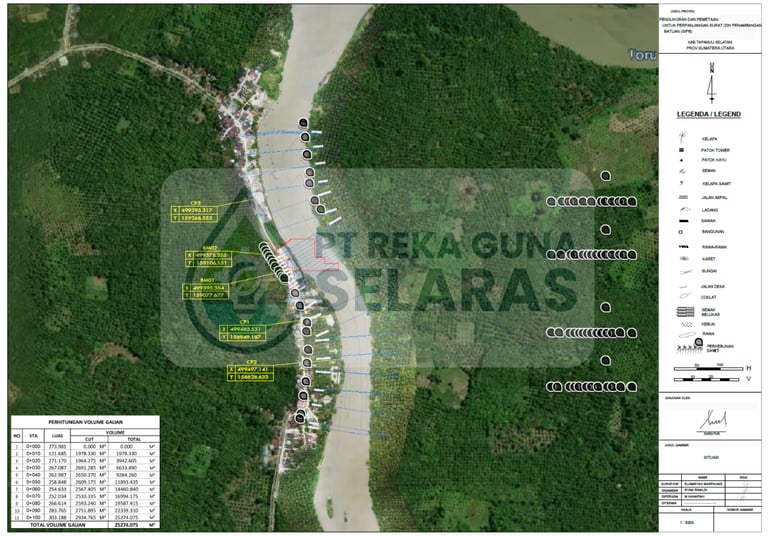
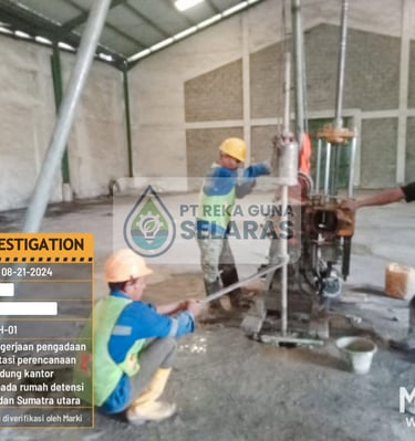
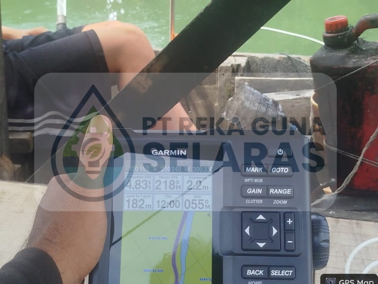
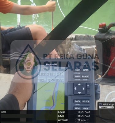
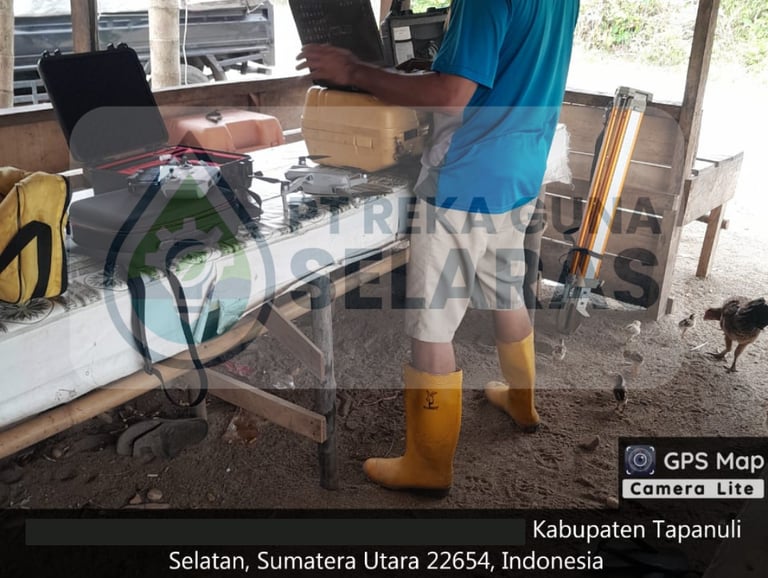
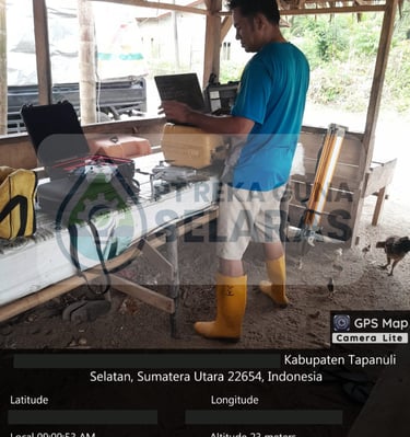
GIS & Mapping Services
PT RGS is here as a professional mapping partner to support your legal, technical, and social needs. From land cover mapping to legal overlays for mining permits and conservation areas—PT RGS ensures you make evidence-based and spatially sound decisions.
Coverage :
Land Cover & Land Use Mapping
For spatial planning, forestry, agriculture and conservation.Delineation of Strategic Areas & Regions
Determining the boundaries of village areas, conservation areas, or customary areas.Mapping for Mining Permit Application (SIPB / IUP / WIUP / IUPK)
Including mining block coordinates, forest area overlays, and tenurial conflict maps.Mapping for Social Forestry & TORA
Compiling spatial documents for legalization of community land access.Landscape Change Monitoring (Change Detection)
Before-after analysis of disaster events, deforestation, or reclamation.Mapping Local Economic Potential
Such as mapping the potential of agriculture, forestry, tourism, and people's mining.


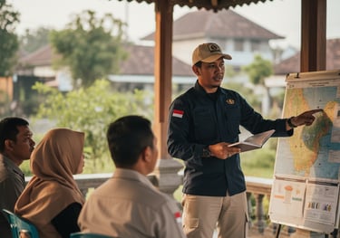
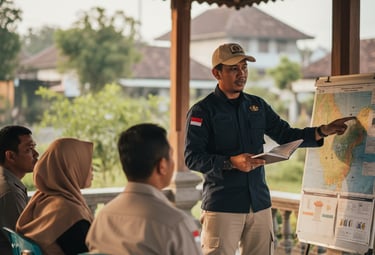
Education & Training
A Trained Community Is a Long-Term Asset for Development
We Elevate the Interests of Nature and Communities in Public Policy Processes.
Advocacy & Policy


Accurate Spatial Data Is the Key to All Wise Decisions
PT RGS provides field-based training: technical, participatory, and contextual. It's designed for village officials, local youth, NGOs, and corporate CSR programs.
Coverage :
Basic to Advanced GIS Training
Including QGIS, drone mapping, and webGIS.Conservation and Climate Change Training
For students, teachers, farmer groups, village youth, and local officials.Data-Based Village Planning Workshop
Including participatory mapping and the preparation of spatial-based RPJMDes.Environmental Education Classes for Schools
Fun learning program in the open or blended learning.Training for Trainers (ToT)
To establish local facilitators in the field of conservation and GIS.
PT RGS champions fair and participatory environmental governance. Through research, dialogue, and campaigns, we help promote policies that favor nature and society.
Coverage :
Advocacy for Recognition of Indigenous Territories and Social Forestry
Legal-formal assistance for submitting management decrees.Public Awareness Campaign and Social Media
Including digital content, campaign videos, and public education.Multisector Policy Dialogue
Facilitating discussions between the community, academics, and government.Local/National Policy Studies and Recommendations
Data analysis and policy research for systemic change.Legislative Assistance
Assisting in the process of drafting environmental-based Regional Regulations/Local Regulations.


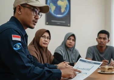
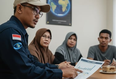
Consultation & Mentoring
We Accompany the Process Towards Fair, Data-Driven, and Sustainable Development
PT RGS helps villages, organizations, companies, and governments design environmental and social programs collaboratively and measurably.
Coverage :
Community-Based Ecotourism Development Assistance
From planning to branding and marketing.Preparation of Environmental Documents (UKL-UPL, DED Area, etc.)
Together with technical partners and a team of certified professionals.Participatory Spatial Planning (Village / Area / Disaster Mitigation)
With the support of spatial and social data.Environmental and Social CSR Planning Consultation
For palm oil, mining, energy, etc. companies.Local Community Business Assistance
Such as sustainable agriculture, essential oils, and forest crafts.
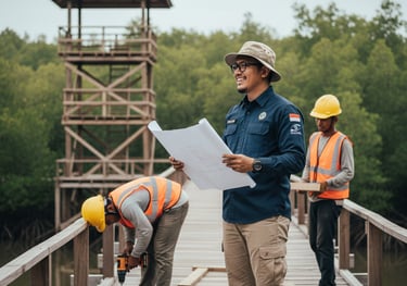
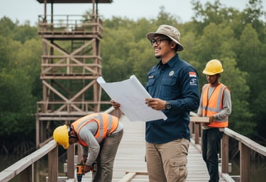
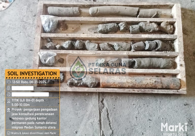
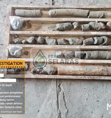
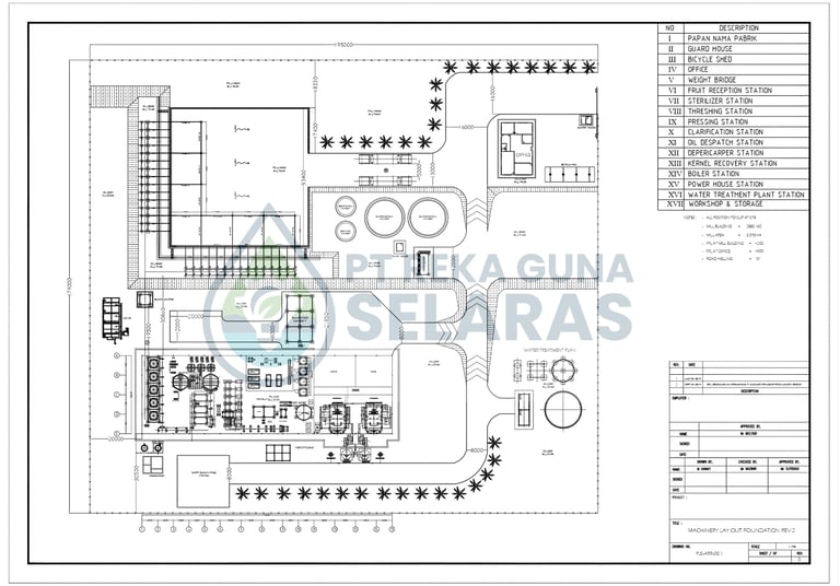
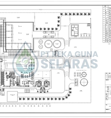
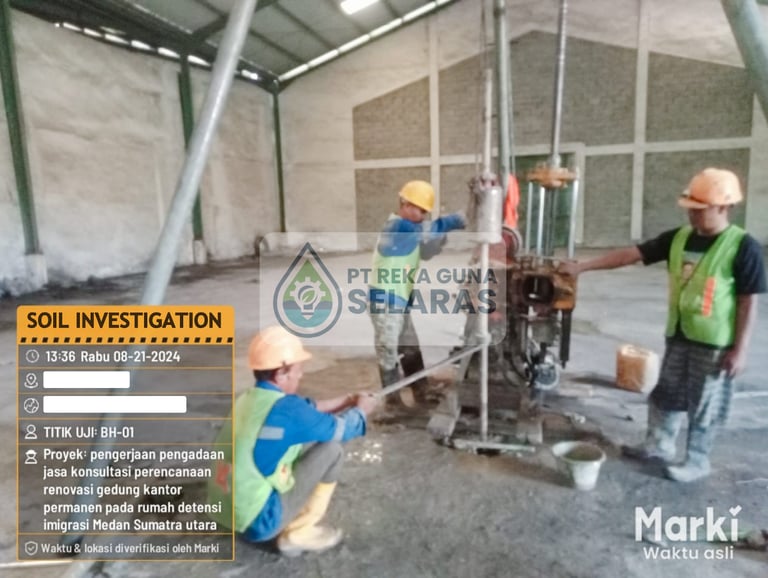
Nature-Based Construction & Infrastructure
We Build Facilities That Are Functional, Aesthetic, and Sustainable
PT RGS provides nature-based infrastructure planning and development services that support conservation, eco-friendly tourism, and community economies. We employ a local, efficient, and environmentally adaptive approach.
Coverage :
Construction of Guard Posts, Observation Towers, and Educational Tourism Trails
For conservation areas, ecotourism, and forest protection.Climate Adaptation Infrastructure Development
Such as canal barriers, biopores, reservoirs, and participatory-based check dams.Community Business Support Facilities
Compost house, essential oil processing building, HHBK business hall.DED Design for Conservation or Ecotourism Areas
With an environmentally friendly approach and local materials.Project Monitoring and Field Supervision
Done by an experienced technical team and involving local communities.
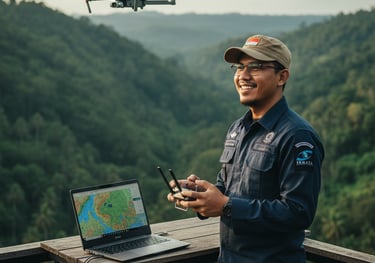
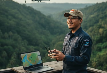
Drone & Aerial Services
See Further, Plan More Precisely
PT RGS provides aerial mapping and documentation services using drones for a variety of technical, visualization, and reporting needs. We combine fast data acquisition and high-quality image analysis in every project.
Coverage :
High Resolution Aerial Survey for Land and Topographic Mapping
Produces orthomosaics, DSMs, and precision contour maps.Monitoring Deforestation, Land Cover, and Landscape Change
For reporting on mine conservation and reclamation projects.Project Visual Documentation (Aerial Photos & Videos)
Suitable for donor reports, CSR, ecotourism promotions, etc.Vegetation Analysis & Land Health Index (NDVI, SAVI, etc.)
For agricultural, forestry and industrial plantation purposes.Basic Drone Training for Communities or Agencies
Field-based certification, security, and operations.


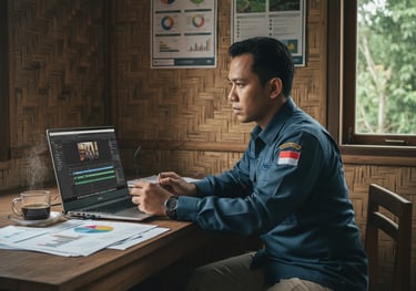
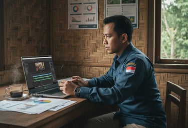
Visual Communication & Environmental Media
We Turn Field Impact Into Inspiring Stories
PT RGS supports your socio-environmental programs with powerful, credible, and impactful visual communications. We weave program narratives into professional documentation that reaches global audiences, including the public, governments, and donors.
Coverage :
Field Documentary Video Production & Program Testimonials
Customized for final reports, training, or promotions.Infographic Design, Modules, and Visual Publications
For educational content, project reports, and social campaigns.Project Report with Professional and Humanistic Design
Digital or print versions for NGOs, CSR, and local governments.Visual Storytelling for Social Media and Websites
Content in carousel, reel, or interactive microsite format.Narrative Map Creation (Story Map) and Online Gallery
For project impact visualization and partner showcase.
Project Gallery of PT RGS
View our portfolio for professional services and consulting.
Contact us


Let's Collaborate for Real Impact.
We are open to professional collaboration, project mentoring, and socio-environmental program development.
Please fill out the form below, and our team will contact you shortly.
Together, we can unite data, local wisdom, and real action.
SEMATA INDONESIA
Protecting forests, coasts and wildlife with community, science and sustainability
CONTACT US
admin@semataindonesia.org
© 2025. SEMATA INDONESIA. All rights reserved.


+62 852 6745 9070
Jl. HM. Joni - Aman 1 No. 09, Kel, Teladan Barat, Kec. Medan Kota, Kota Medan, Sumatera Utara, 20216
SUBSCRIBE US